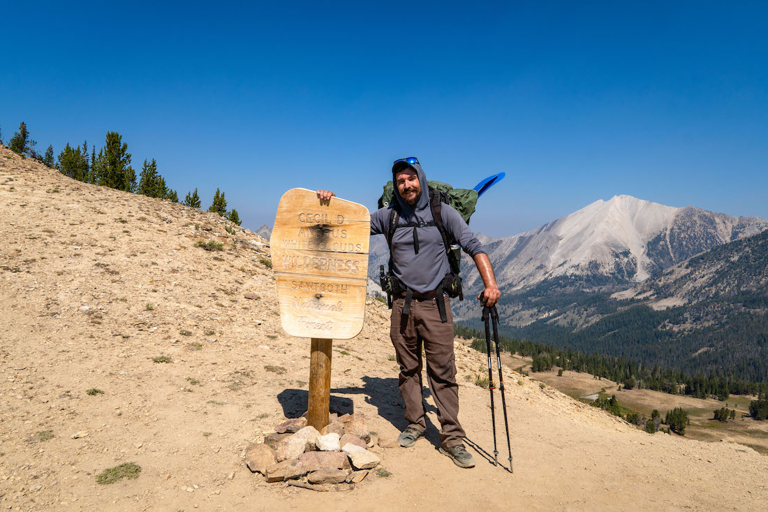
Day 1
Trailhead to Castle Lake
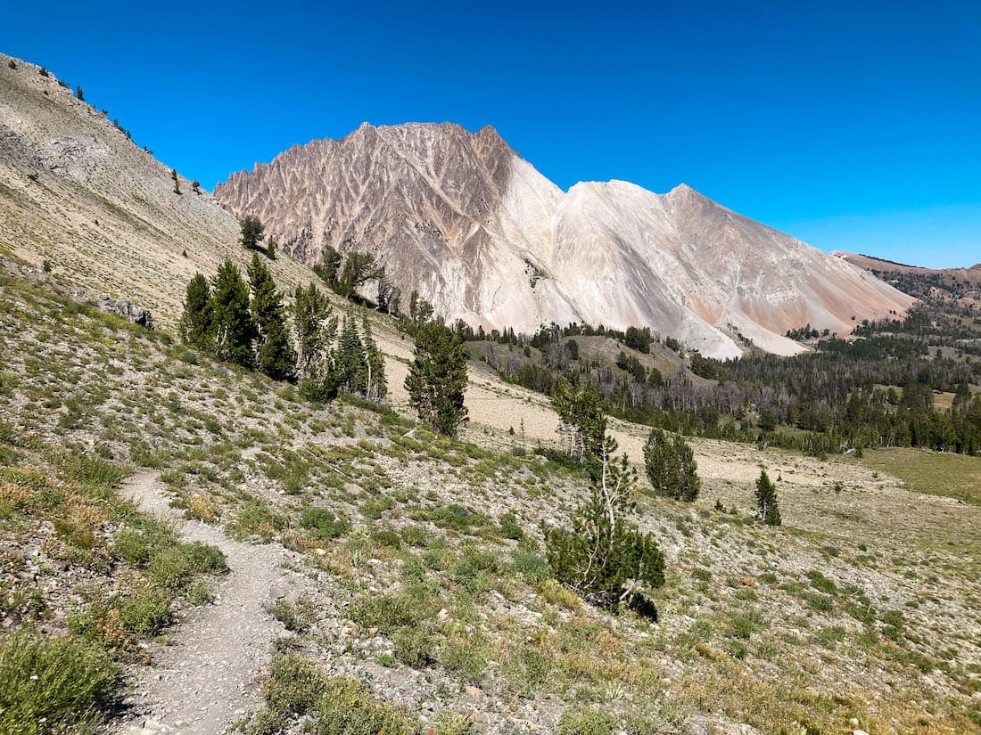
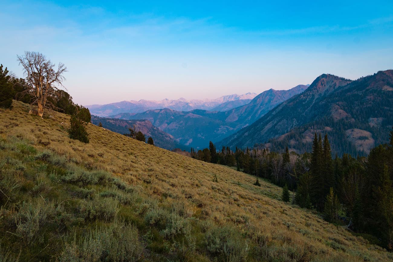
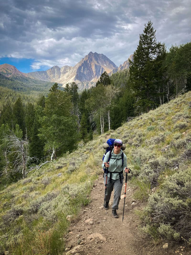
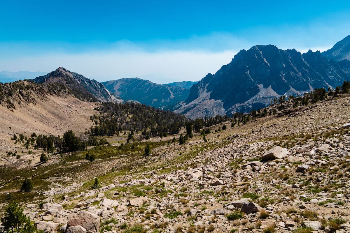
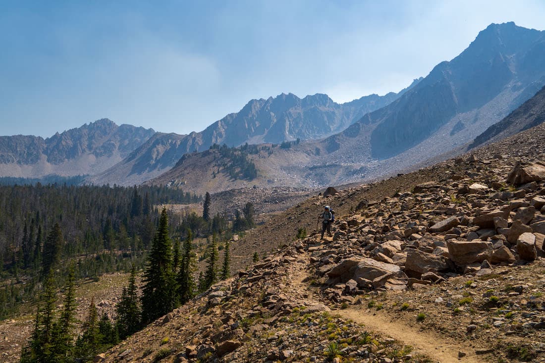
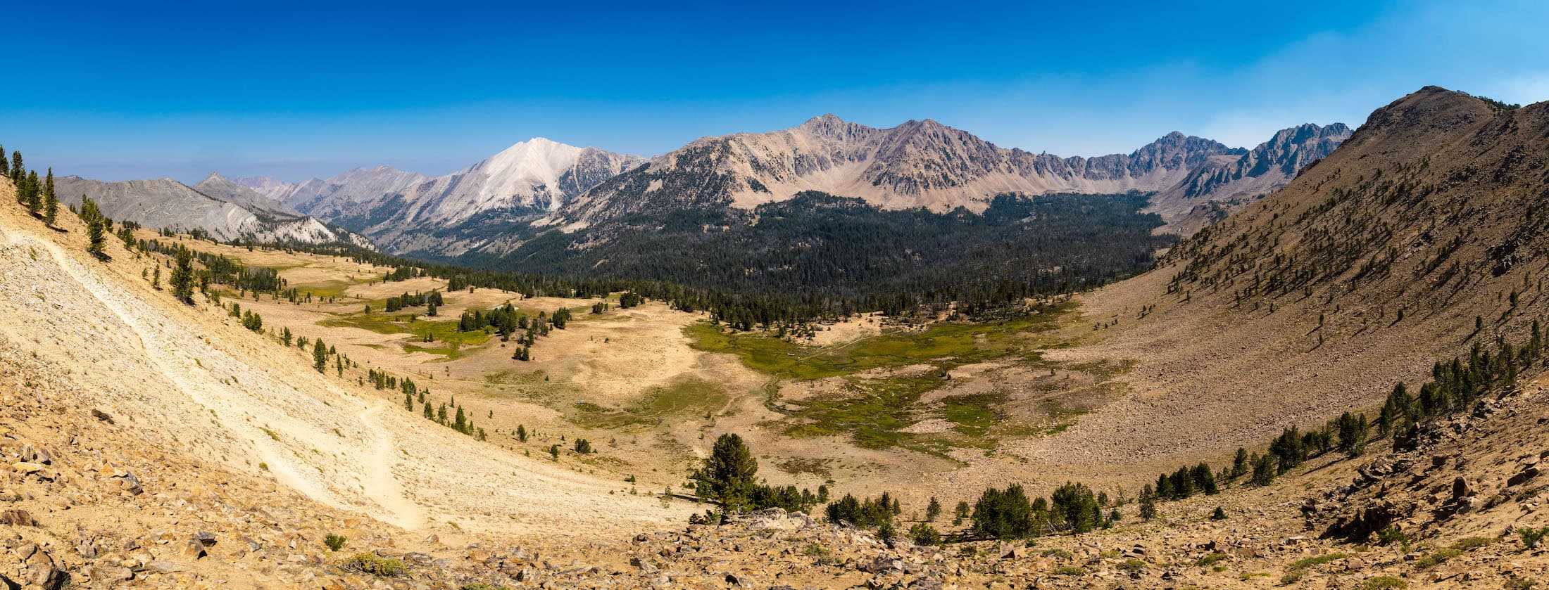
The Castle Lake Loop had been on my radar for a few years and I was excited to finally hike it. Sam and I arrived at the trailhead around 8am. The parking lot had a hand full of cars. The weather was great and the smoke was not too bad considering we were only a few miles away from a wildfire that had been burning for a few months. We hit the trail towards Fourth of July Lake, where the loop junction is. After about a mile and half, we reached the lake. I decided to do the loop counter clockwise, towards the Chamberlain Basin first instead of the more popular clockwise approach. I knew The Chamberlain Basin was one of the highlights of the trip and wanted to experience it with as few other hikers as possible. Since it was Thursday, I knew we would have a better chance at solitude during a weekday as opposed to the weekend. We headed South.
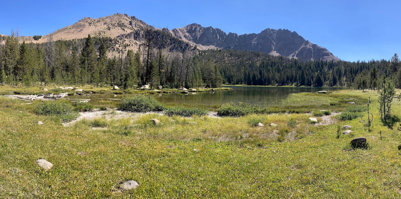
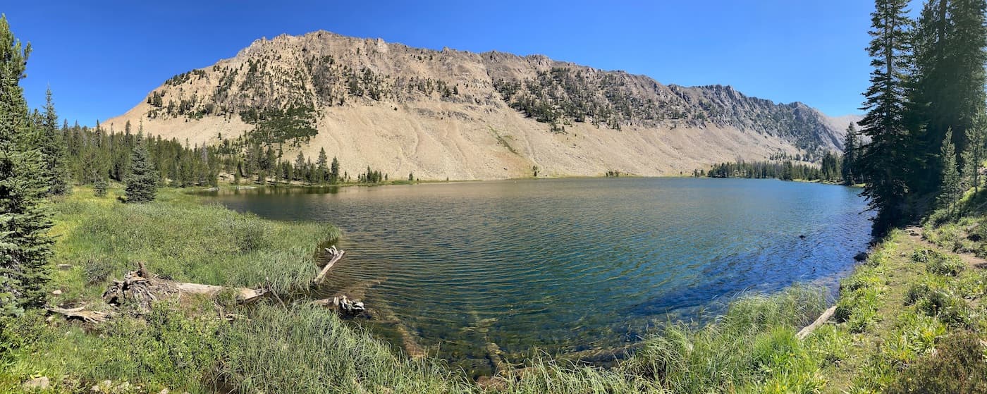
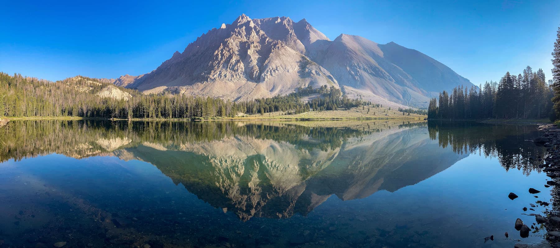
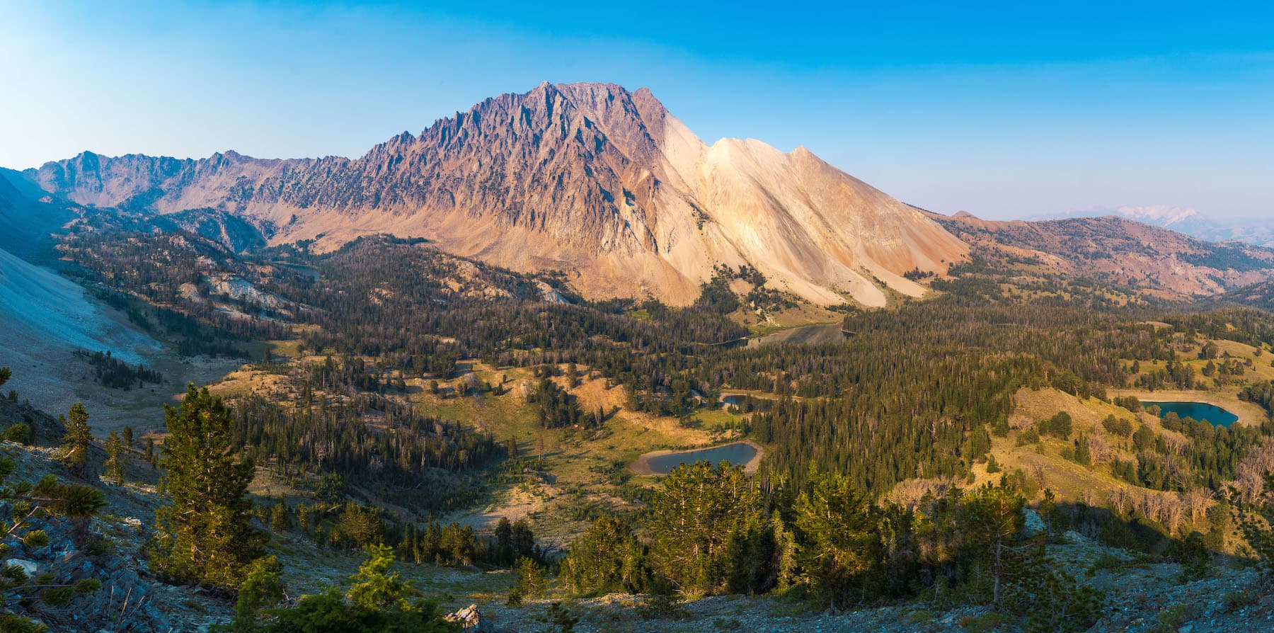
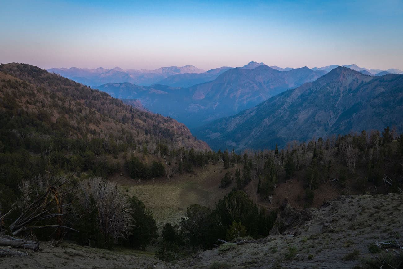
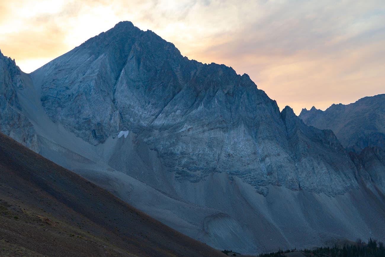
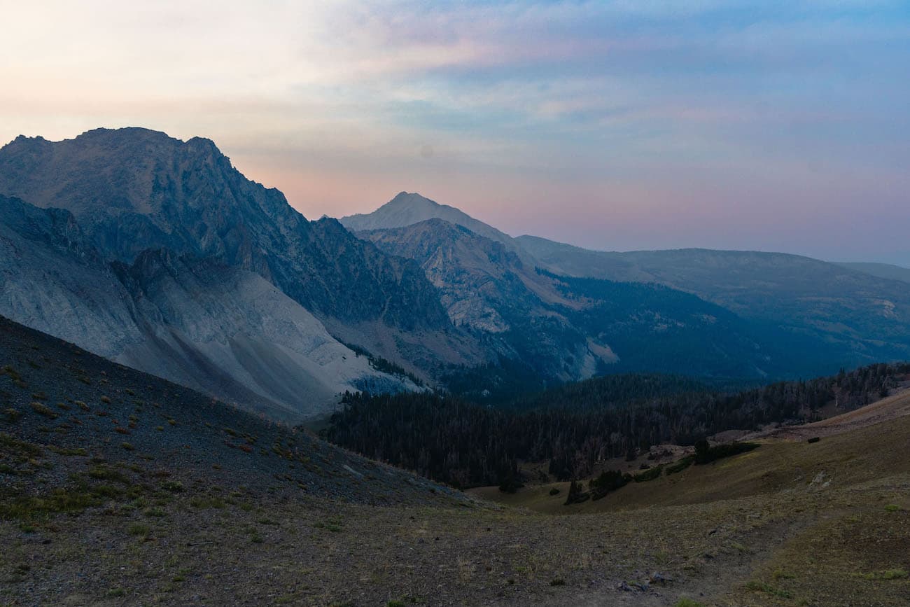
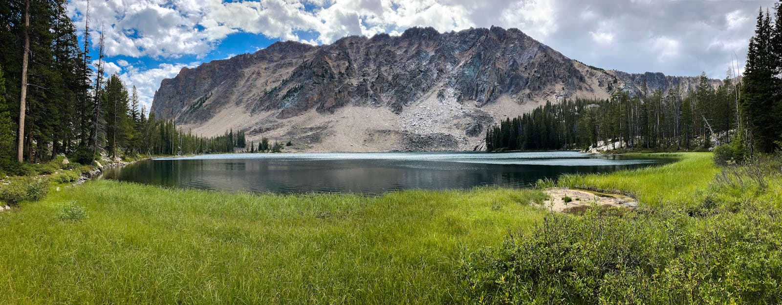
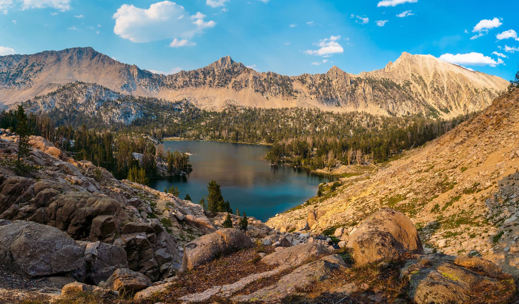
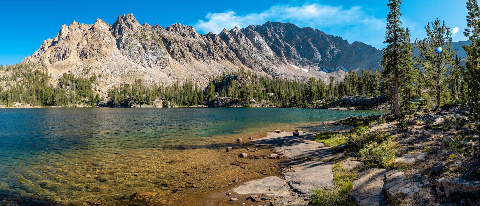
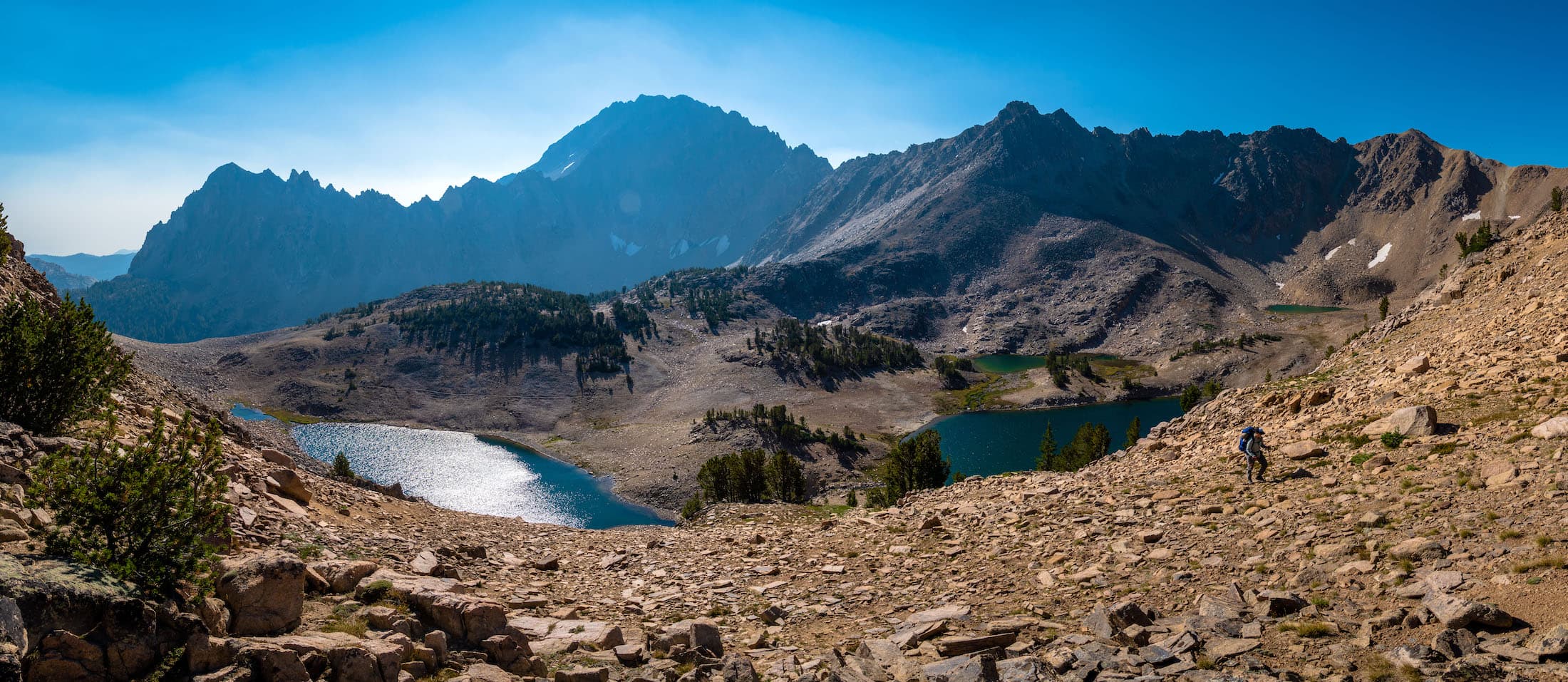
A large fire had burned this area more than a decade ago but there were still many stands of healthy trees. We were hiking parallel to a large ridge, on the other side of which contained the Chamberlain Basin. In about a mile we reached the shores of Washington Lake which lay at the base of the ridge. We continued for another few easy miles until the trail started switchbacking up the ridge. It was at this point we entered mostly burned forest. As we approached our pass, we could see the tip of Castle Peak, the most distinct land mark of the White Clouds. We finally reached the pass and were treated with a stunning view of Castle Peak and the Chamberlain Basin below it. Castle Peak was incredible. A large mountain with a variety of textures and colors. The left side of the mountain is orange-red and has large channels eroded into it while the right side is white in color and has a much smoother surface in comparison. It is one of the most unique and eye-catching mountains I had ever seen. The basin below is comprised of rolling hills, open grassy meadows, stands of pine trees and small alpine lakes. After taking some pictures we eagerly continued down into the lovely valley. The trail meandered through the meadows and took us by a small lake with a nice campsite above it’s shore. For whatever reason none of the lakes in this basin have names on the map. My destination was the medium sized lake at the base of Castle Peak. After a leisurely downhill stroll we arrived at the lake.
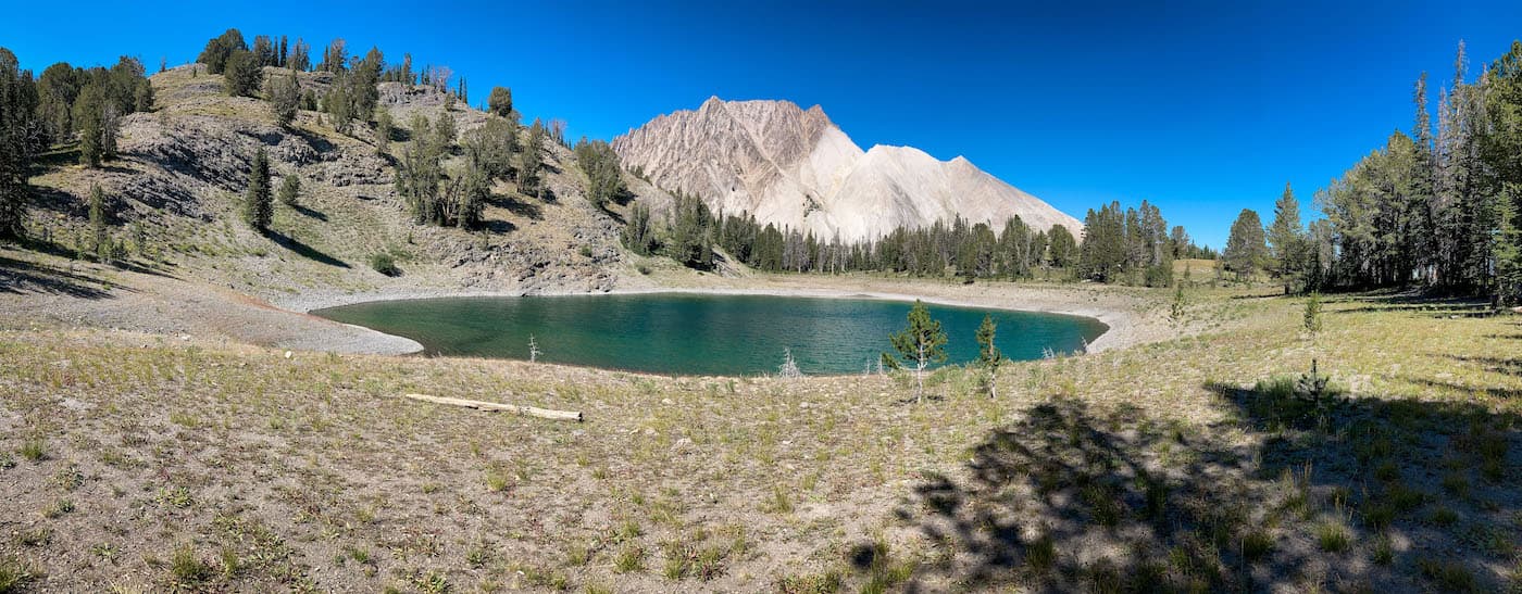
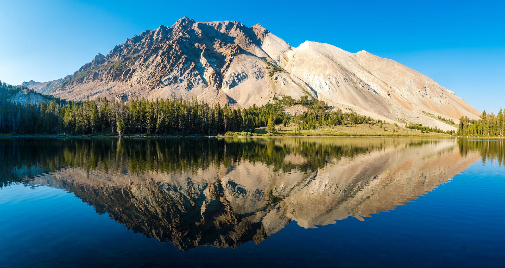
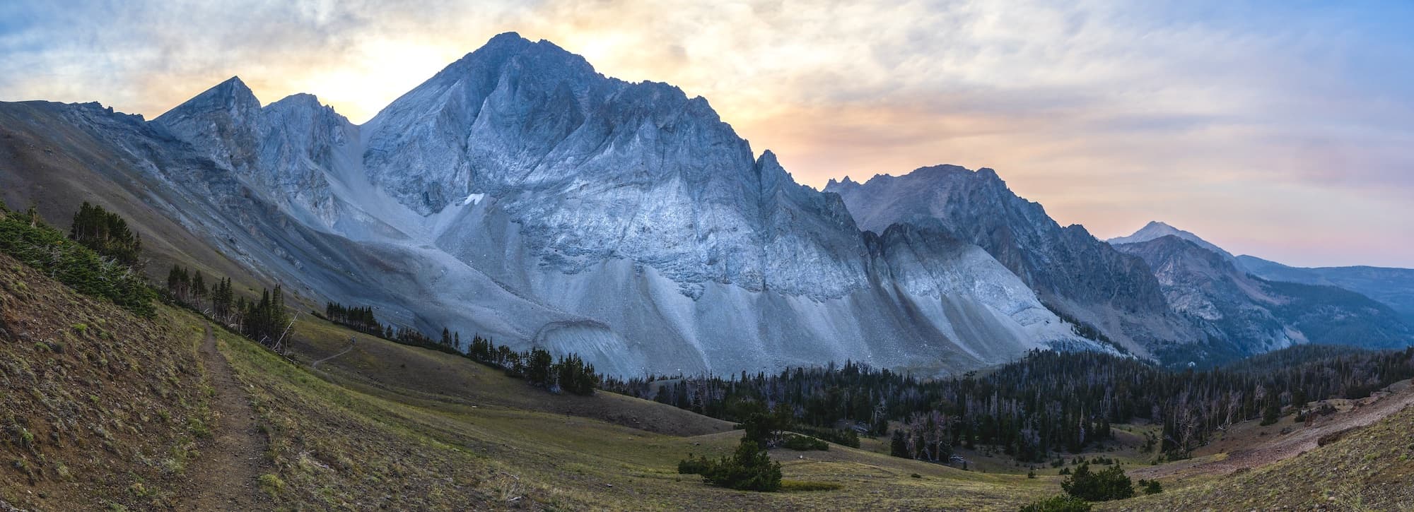
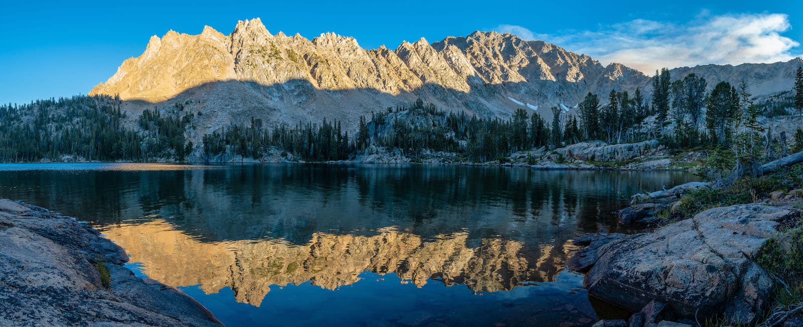
There was only one other small group camping at the Eastern end of the lake. We gave them a wide birth and found a great spot on the South side of the lake with an incredible view of Castle Peak on the other side. We set up camp and our hammocks and began to relax. The days hike was not super difficult but it was quite hot. We spent the afternoon chilling in our hammocks and admiring the view. In the late afternoon I decided to go on a walk with my camera and get some photos. The lake was very still and gave a beautiful reflection of Castle Peak. I headed West and rounded the lake and continued uphill. I found a scenic meadow and took some photos. I returned backed to camp, we had dinner and then turned in for the night.
Day 2
Castle Lake to Trail Side Camp
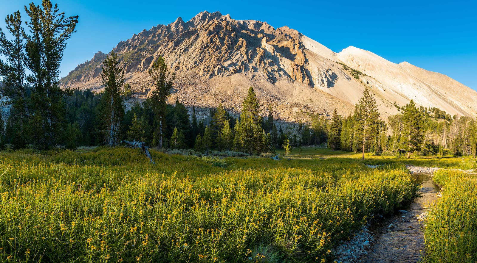
Our second day we had planned to spend at camp and enjoy the scenery. I woke up early and went on a walk with my camera and scrambled a peak to get some early morning shots of Castle Peak. When I returned, the water on the lake was still and reflected the Peak. It was very serene. We had our breakfast and had a lazy morning.
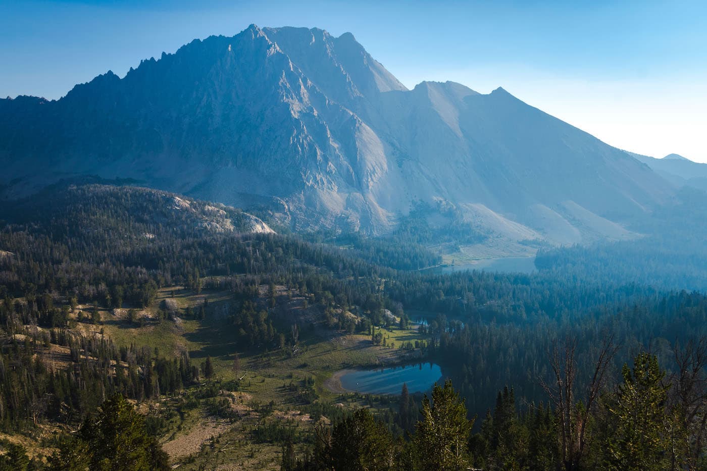
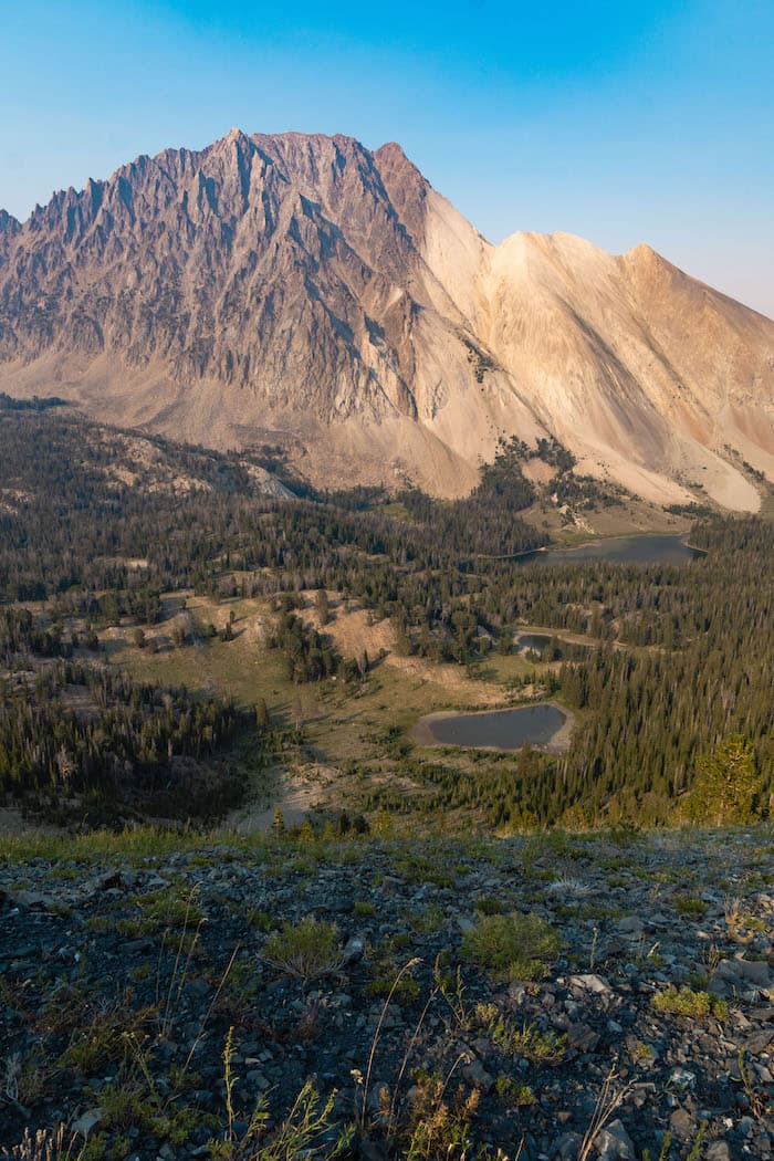
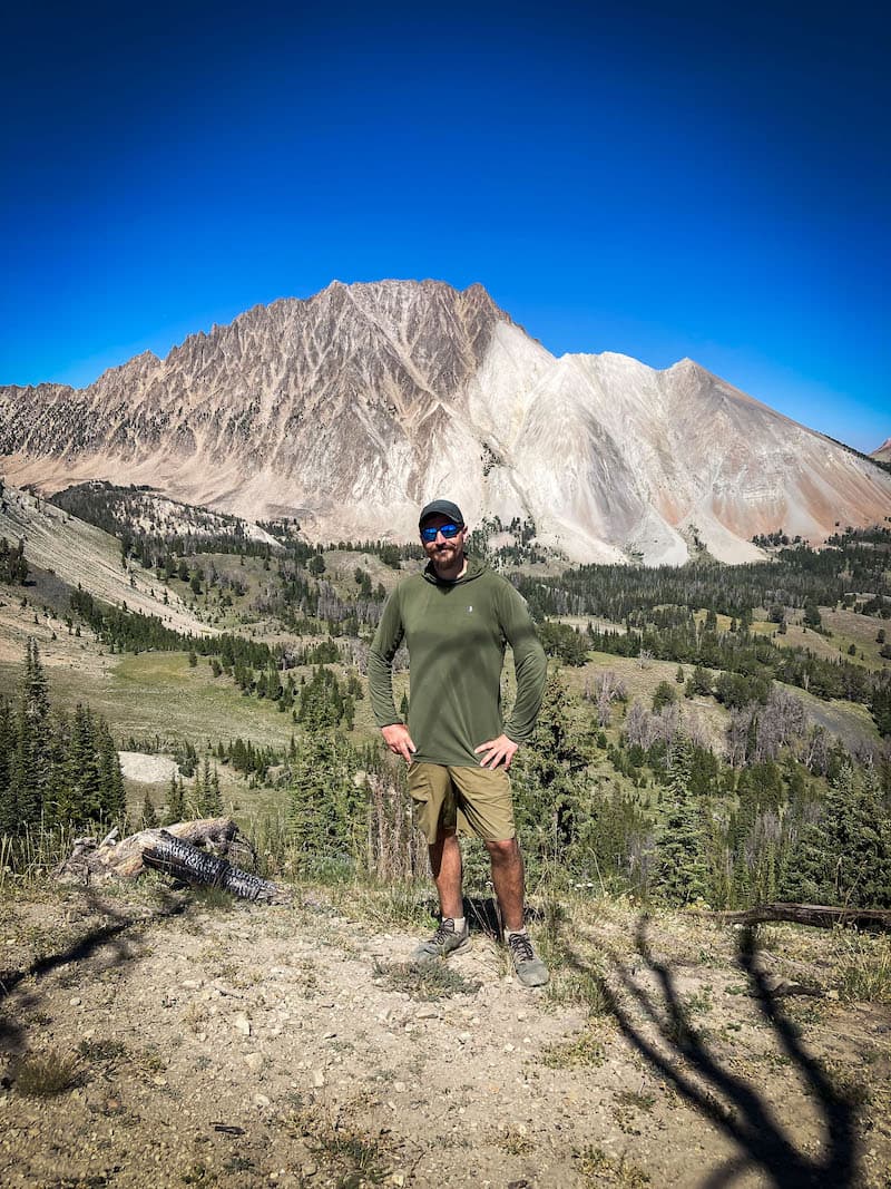
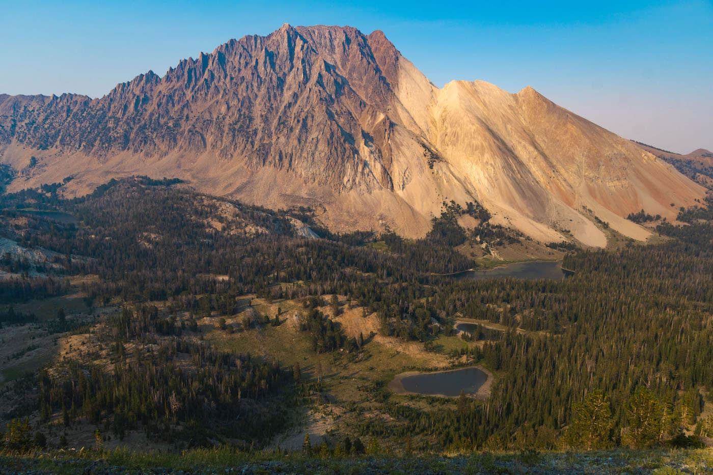
Around noon we inflated our pack raft and went on a float around the lake and enjoyed some beers. After some talk, we agreed we should pack up and cover a few miles to break up the trips mileage a little better. Before we left I scrambled the peak again and got some great late afternoon shots of Caste Peak and the Chamberlain Basin below. I returned to camp and we left in the hazy late afternoon light.
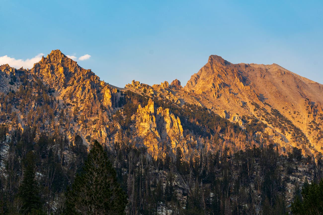
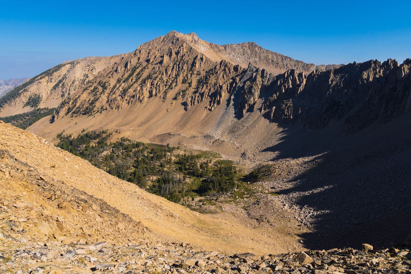
We headed out towards the Castle Divide which was the Eastern shoulder of Castle Peak. It was a beautiful section of trail and the golden hour light made it all the more magical. The trail slowly climbed and meandered higher, offering views of the mountains and valleys off to the East.
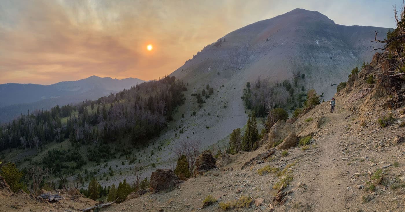
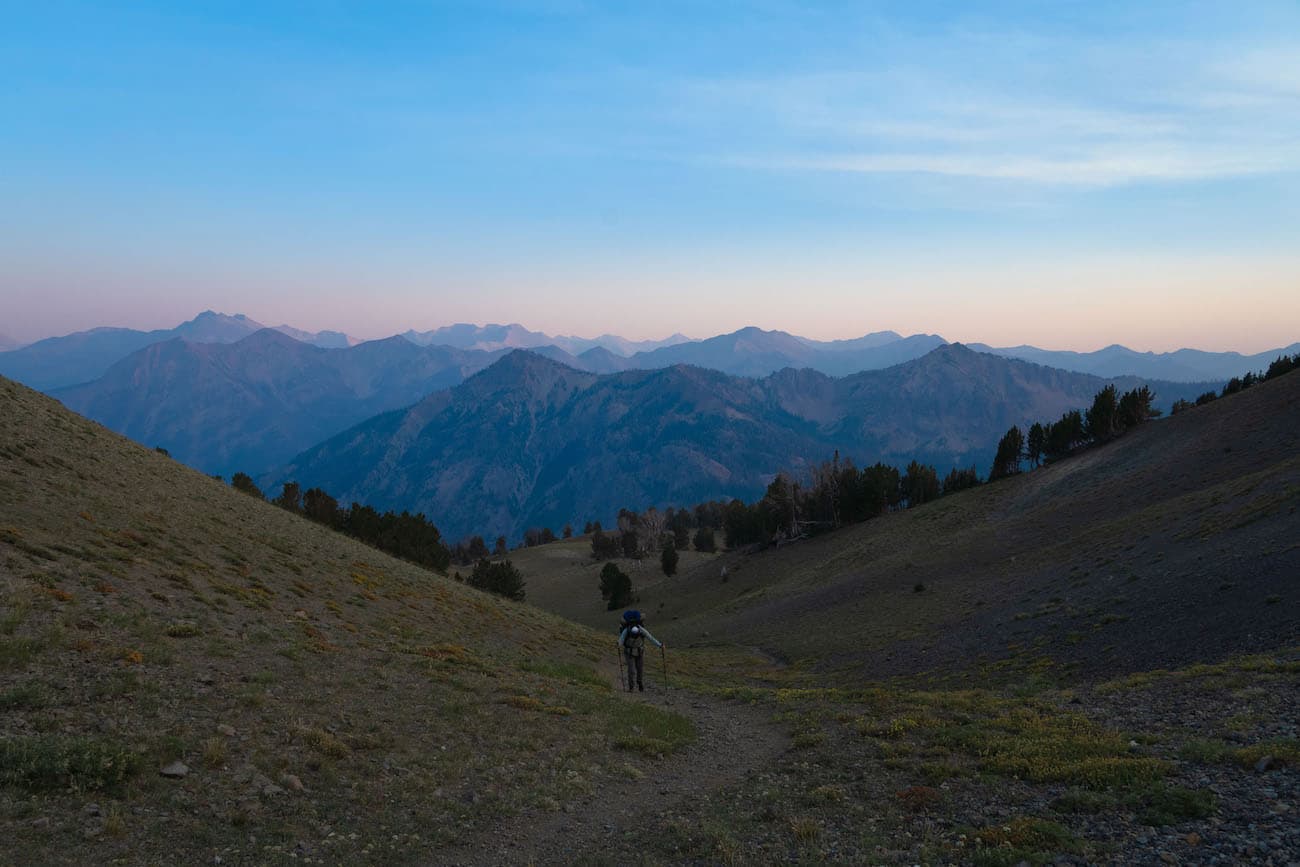
The light was fading as we finally made it to the top of the Castle Divide. The view of Castle Peak from this angle was stunning and unique. We gazed at the rest of the White Cloud range which extended North. It was getting dark and we needed to move on and find camp. I had read about a lake that was hidden in a nook North East of Castle Peak. I was looking for a goat trail that led there but the lack of light made it very hard. We continued downhill back into the tree line. It had gotten dark. I was a little disappointed we didn’t find the lake. We found a suitable camp spot near the trail and called it a night.
Day 3
Trail Side Camp to Hummocks Lake
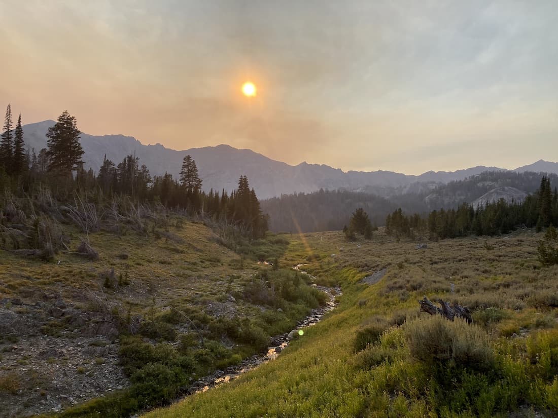
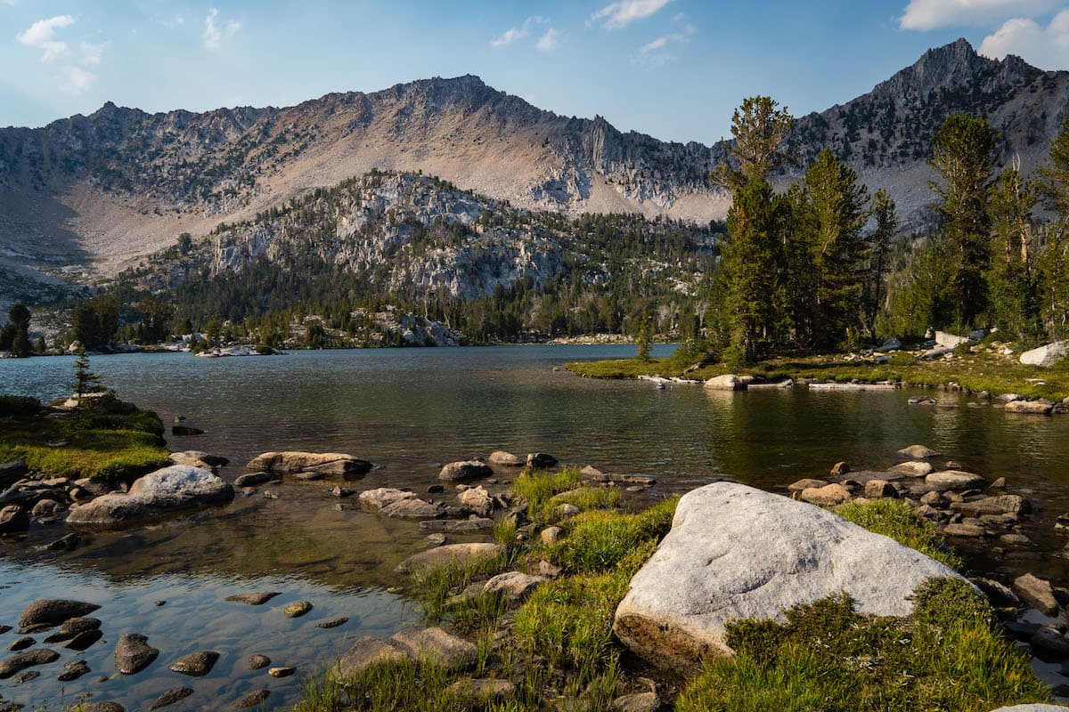
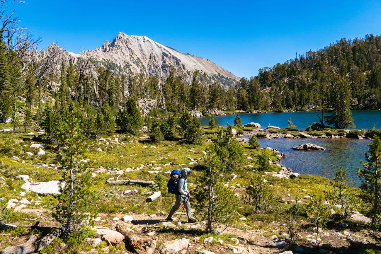
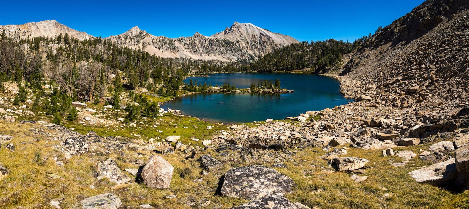
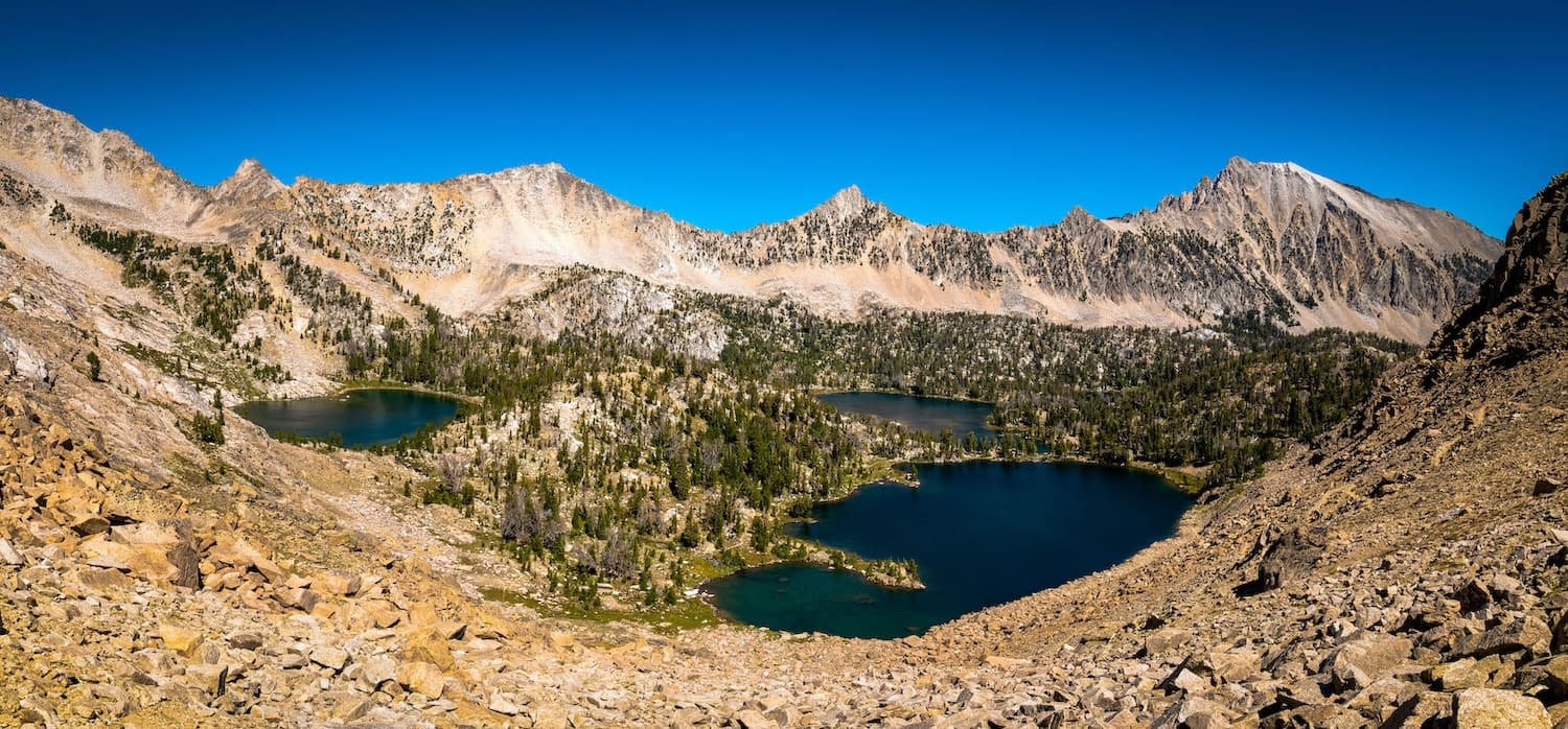
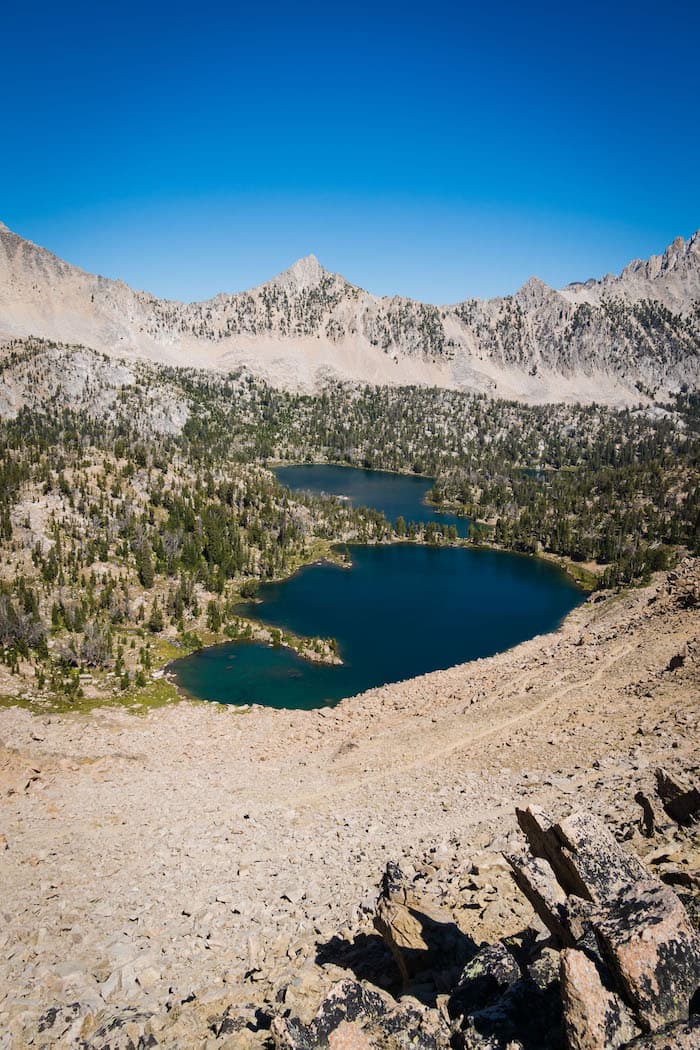
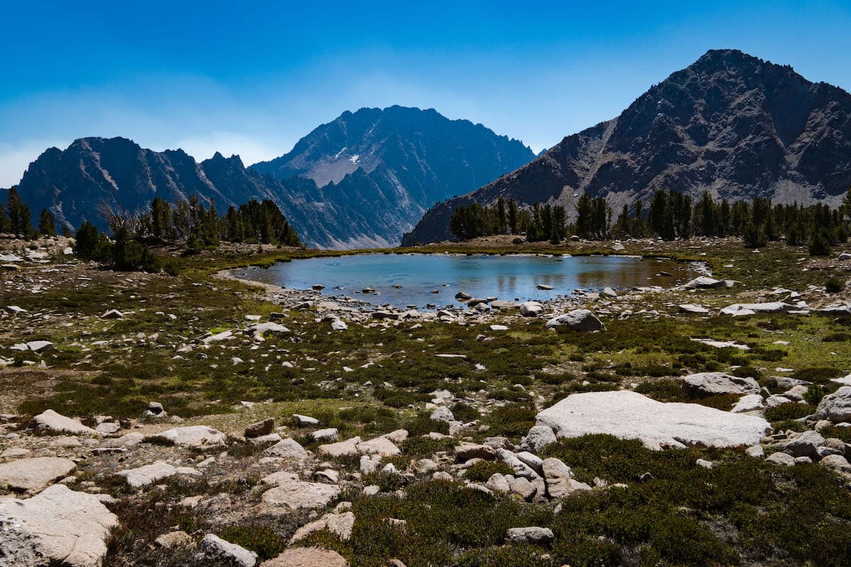
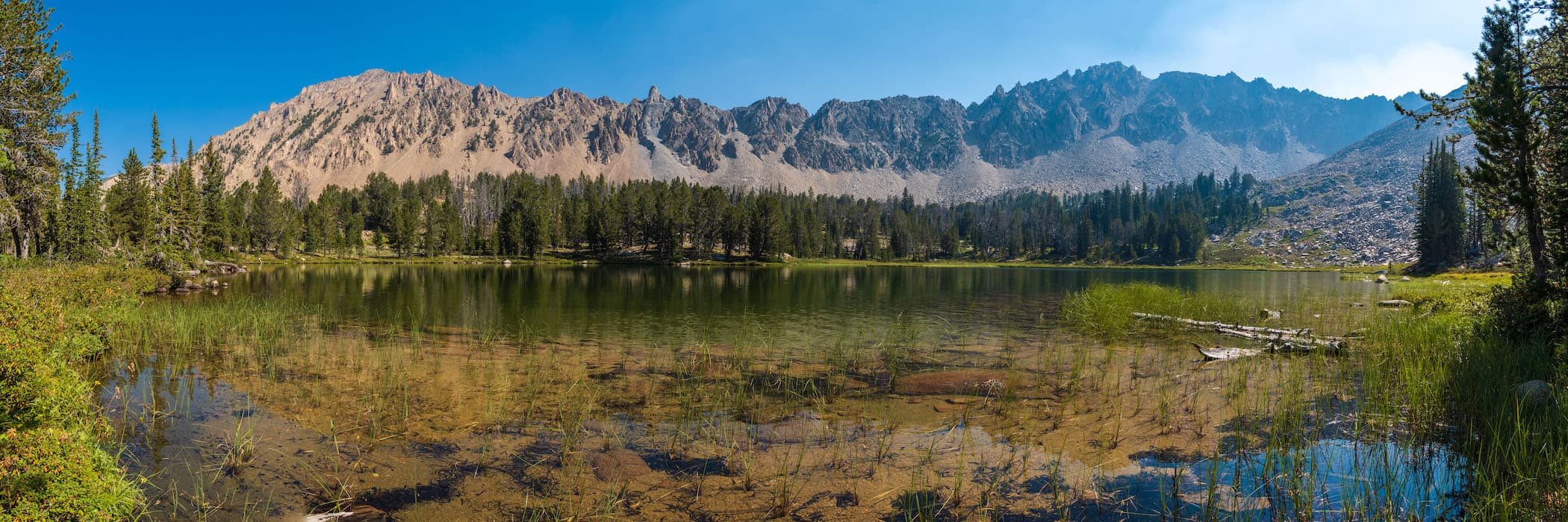
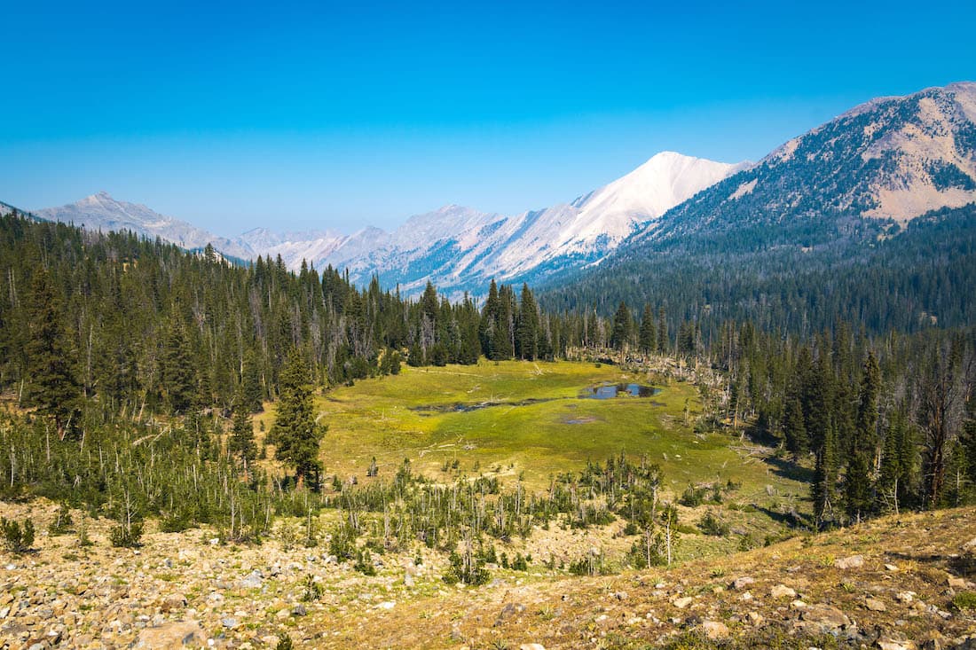
We woke up at our impromptu camp and packed our stuff. It was less smokey and the winds had brought a few clouds. We got back on the trail and headed for our next destination, Hummock Lake in the Boulder Chain Lakes area. The trail took us downhill first to a junction with the Livingston Mill Castle Divide Trail. We went West, up towards Boulder Chain Lakes. It wasn’t long before we arrived at the lowest in a the series of alpine lakes. The Boulder Chain Lakes are a chain of medium sized lakes that all feed into one another. The lakes lay between two high rugged ridges on either side. The trail weaved through these lakes, slowly gaining elevation. Each lake was unique and had its own charm. We stopped at one and had lunch.
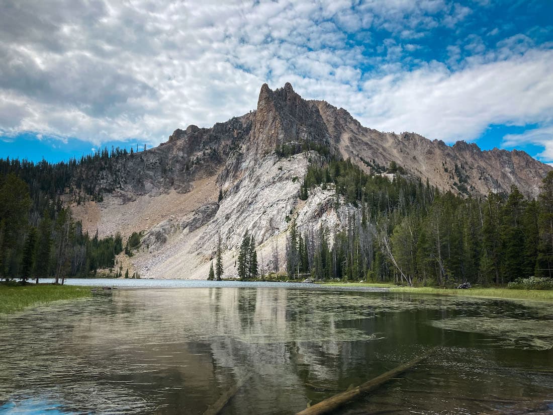

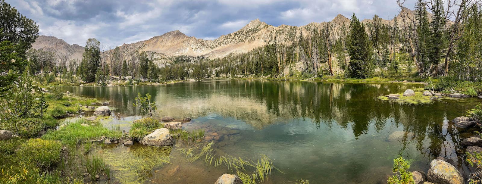
After lunch we started out again and the trail got a little steeper as it took us to the higher cluster of lakes. These lakes turned out to be the prettiest of the lot. We were greeted with a lake with a unique hourglass shape. Just beyond that was Hummock Lake, the largest of the Boulder Chain Lakes. After some scouting we found a nice camp spot.
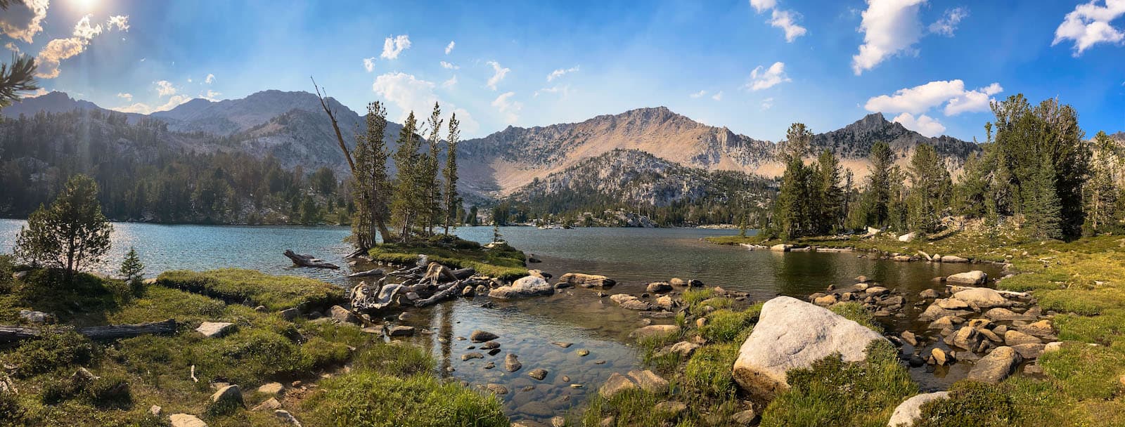
The lake had great views of the rugged mountain ridges on almost all sides. This whole area was very beautiful and almost looked landscaped. There were many inlets rimmed with grassy meadows and rocks. It was however, quite a windy lake which made it hard to boat around in our little pack raft.
In the late afternoon we went on a walk around the South shore of Hummock lake and continued up the trail to Scoop lake which featured a higher vista of Hummock Lake below. We hung out for a bit, taking some pictures and enjoying the view before continuing back to camp. That night the wind blew in smoke from the wildfire, which combined with the high winds, made for a difficult night sleep.
Day 4
Hummocks Lake to Quiet Lake
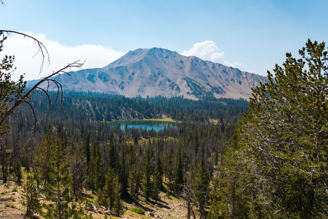
After a smokey windy night, I awoke to clear skies and went on a morning stroll with my camera to nearby Hourglass Lake. Upon some exploration I found a great spot that I kind of regretted not finding earlier. The spot and Hourglass lake in general was much more sheltered from the winds than Hummock lake.

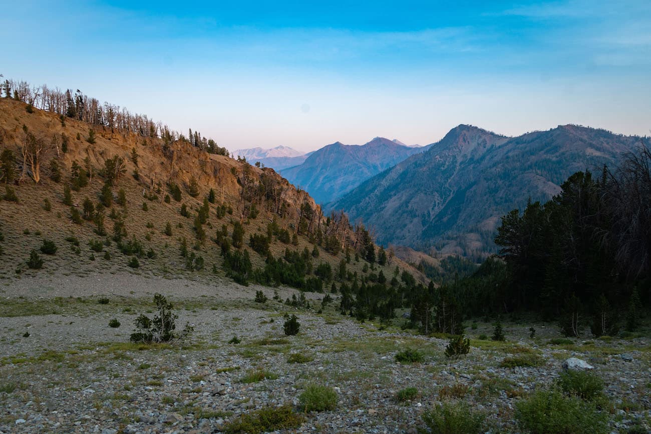
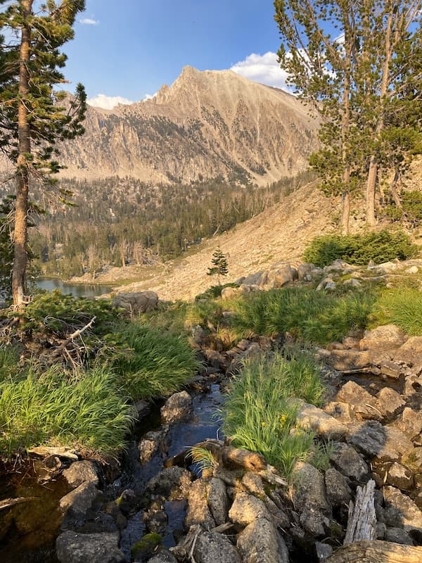
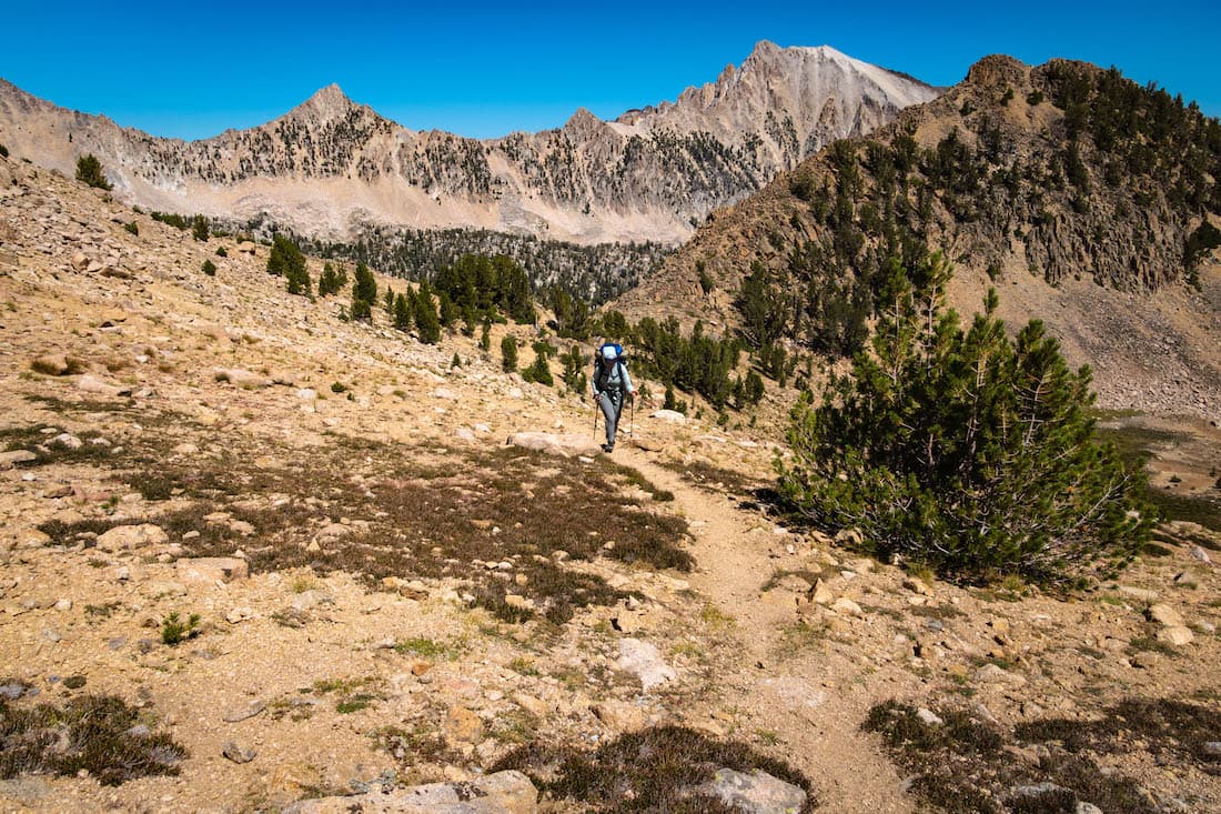
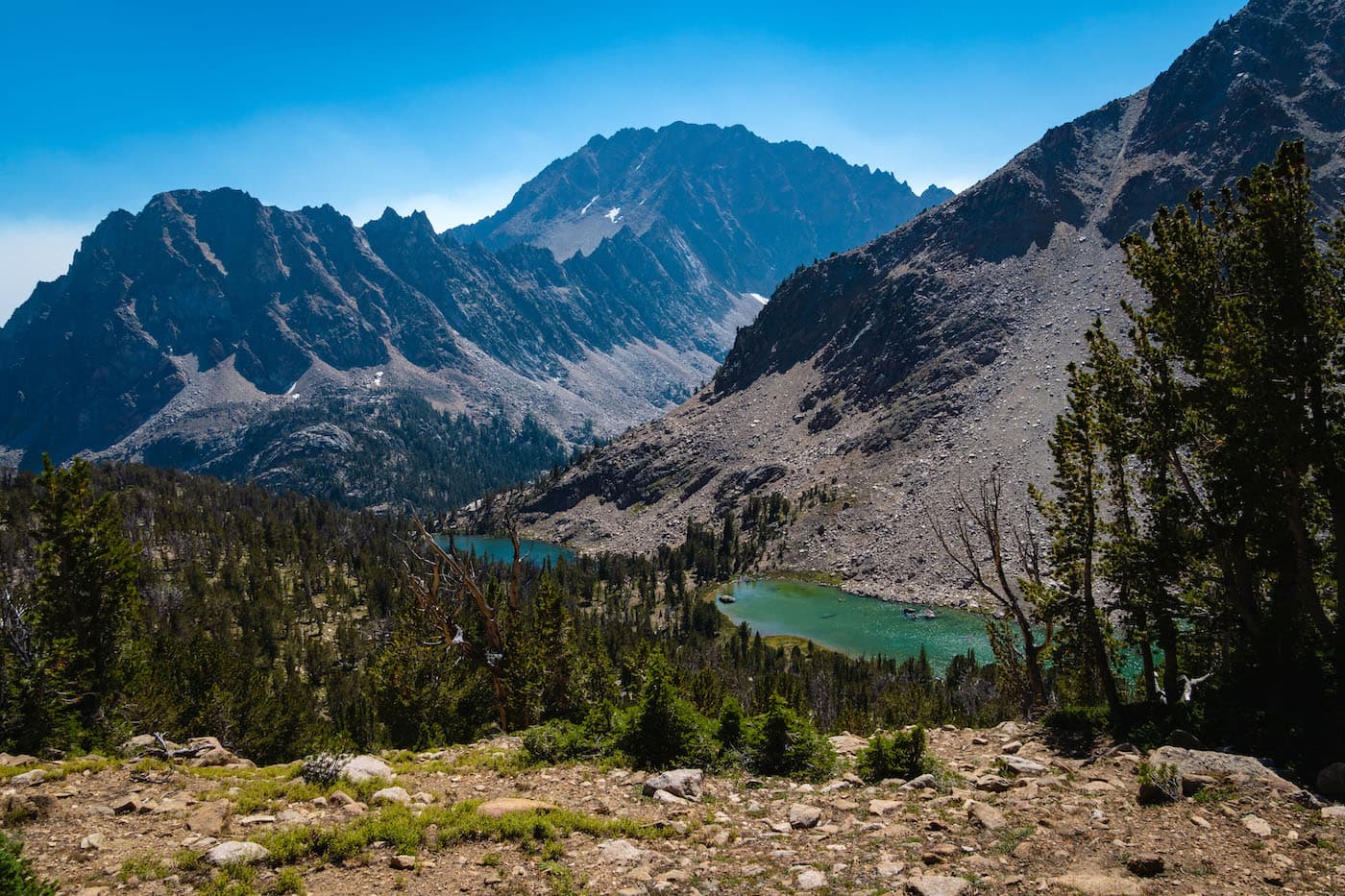
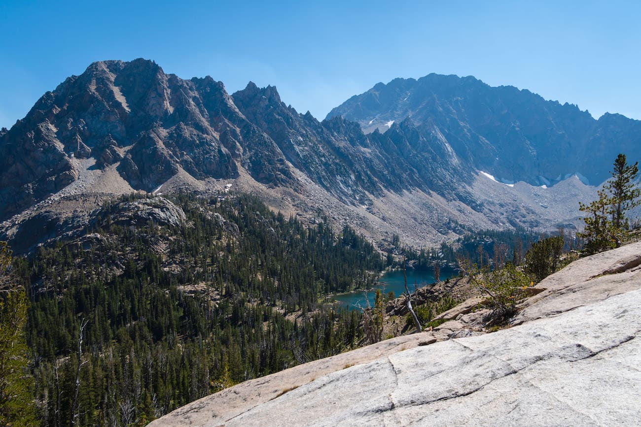
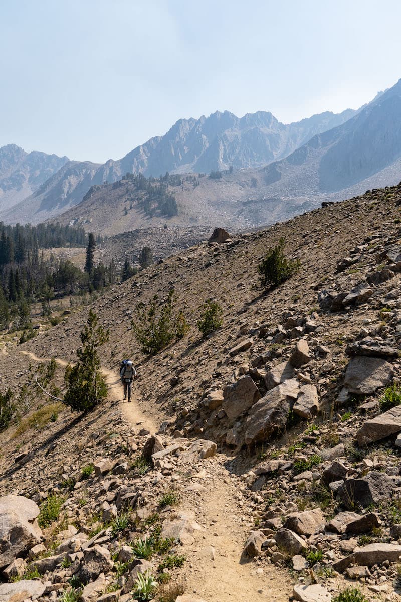
After some breakfast and coffee, Sam and I continued our journey which would take us past Scoop lake and up to the pass above, rightfully called Windy Devil Pass. The smoke had mostly cleared by this point and it was a beautiful sunny day. We headed back up to Scoop lake and continued past it to a series of rocky switchbacks. In not to long we were at the top of Windy Devil Pass which offered great views of the Boulder Chain Lakes we had just hiked up from. We were now in open rocky high country.
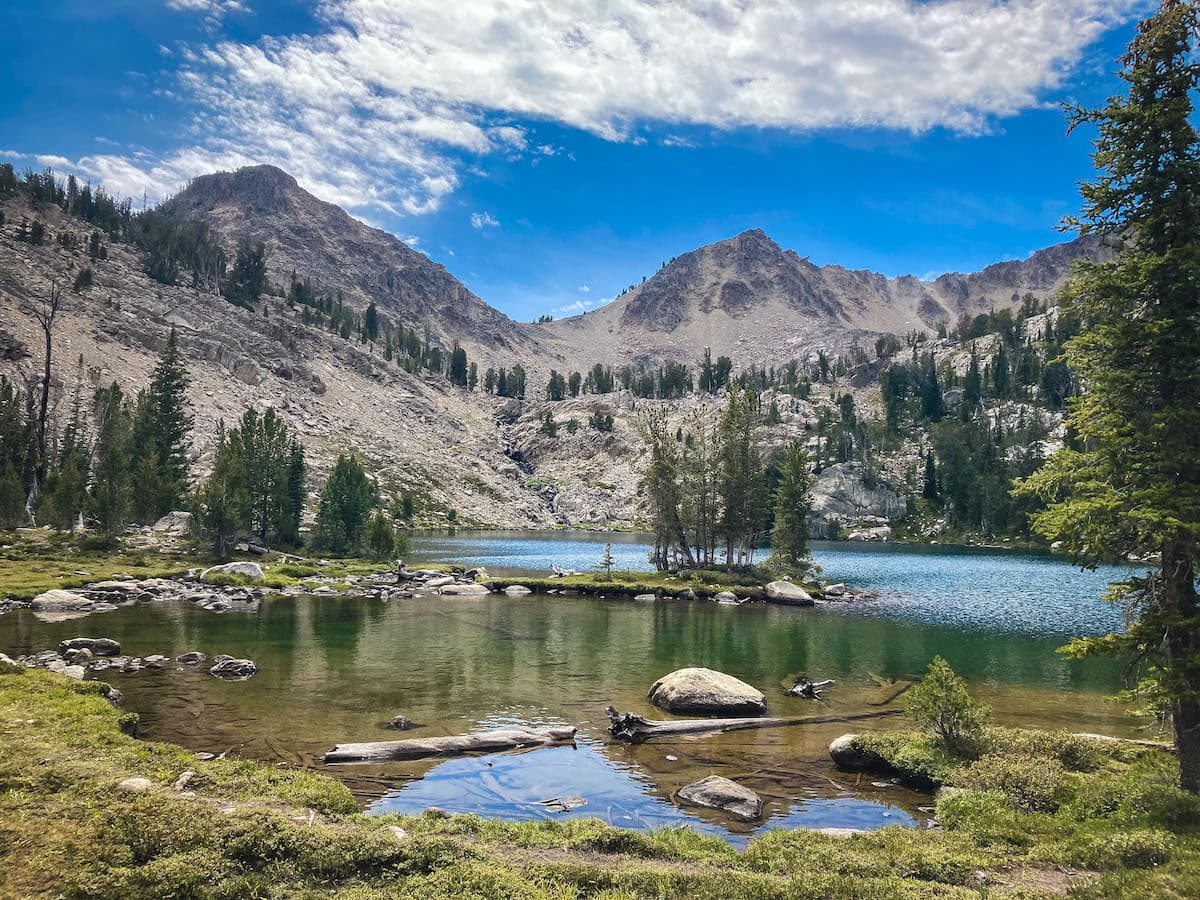
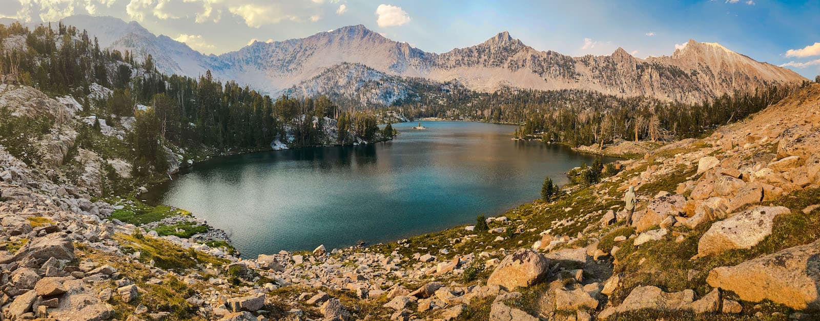
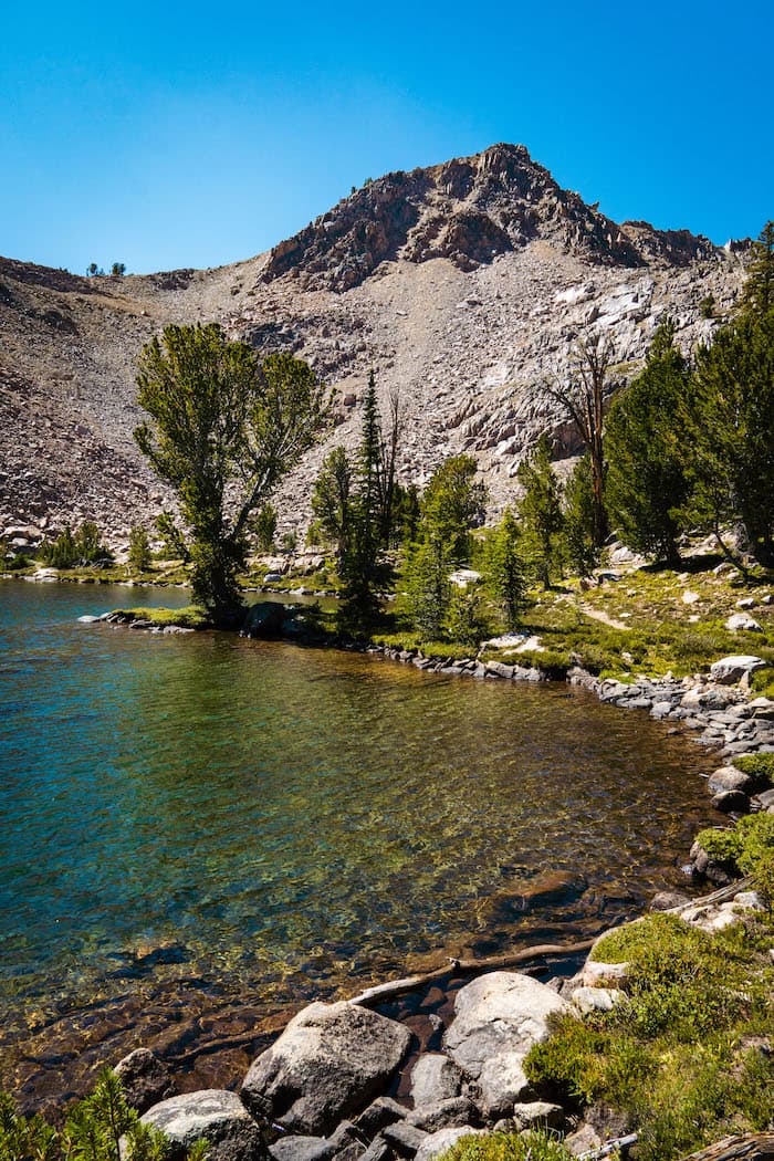
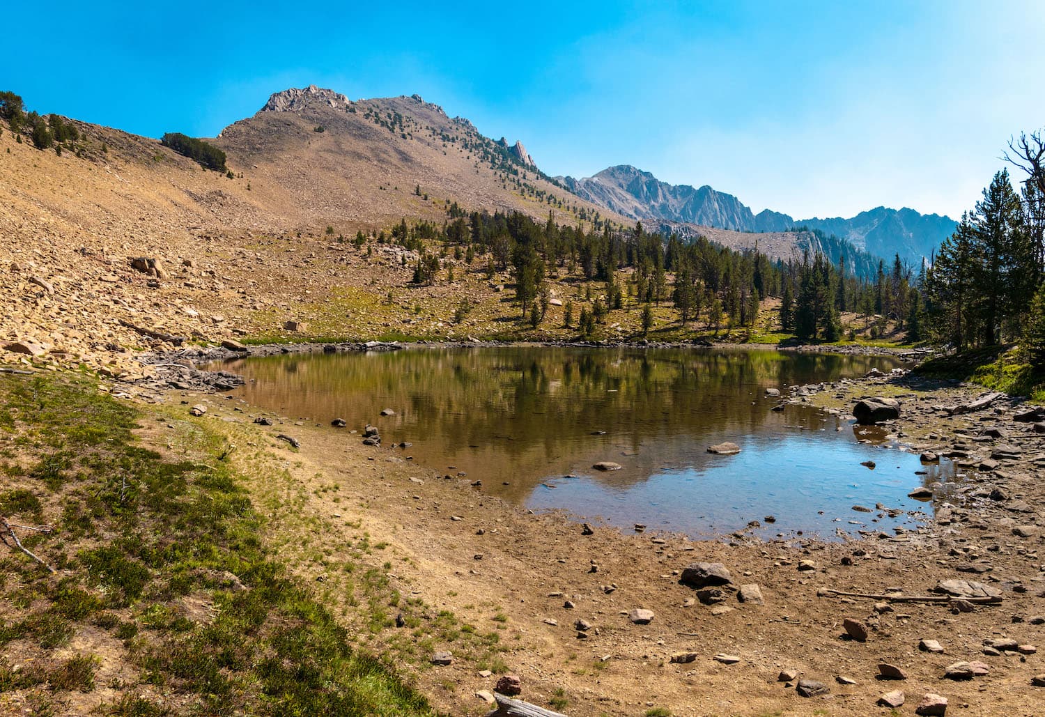
We continued a little ways until we saw a small alpine tarn with Castle Peak standing prominently behind it. We were heading to Quiet Lake which is located at the bottom of the South side of Castle Peak. This tarn marked where we must leave the trail and begin an off trail traverse down to Quiet Lake. We continued downhill to a couple of small lakes. The route got steep in some places but there was a well traveled goat trail to follow. The views of Castle Peak got better and were a lot different than the views from the Chamberlain Basin. We continued the steep descent down and got our first glimpse of Quiet Lake down below.

Finally we reached the bottom and headed South to the shores of Quiet Lake. The lake was stunning and located below a sawtooth ridge that extended from Castle Peak. We headed South along the Western Shore until we found a great campsite at the lake's southern end. We set up our tent and hammocks and enjoyed the afternoon. It appeared we had the lake all to ourselves. The lake was mostly windy but the Southern end, where we were, offered some shelter from it. I went on a little walk and took some photos in the afternoon. It was a very photogenic lake. I returned to our camp and continued taking photos as the light changed.

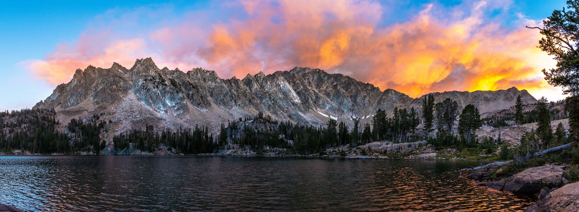
We made dinner and were treated to a nice sunset. The smoke from the nearby wildfire was rising up behind Castle Peak and being lit up by the setting sun. Sam turned in for the night as it got darker. I decided to do a little fishing as we were in an ideal spot for that. Within four casts I had a fish on! It put up a good fight and was quite the specimen. I fried it up and ate it before turning in for the night.
Day 5
Quiet Lake to Trailhead
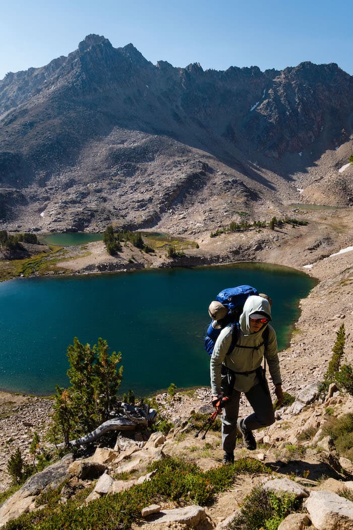
We awoke fairly early for we had some serious scrambling and hiking to do, not to mention a seven hour car ride back home. We ate breakfast and headed out. This was to be the most challenging section of our trip. There was no official trail for the next couple miles. We had to scramble up a boulder field to the rugged Four Lake Basin above us, then summit the pass above that, and descend steeply into the Born Lakes area on the other side. The trail description I had read noted it as very steep and precarious. We started our uphill scramble.


After a while we reached the Four Lakes Basin and our route leveled out as we followed a path through the lakes. It was still a very rocky desolate area with a few groupings of trees. We continued on our faint and rugged path up the steep rocky slope to our pass.

At last we reached the top. I spotted our steep goat trail down to the valley below and we began to descend.
On our way down we met a couple from White Salmon who were just starting their loop. They told us of a beautiful section of the White Clouds to the North that we should check out. After some chit chat we continued on down. We finally left the loose rocky slopes and followed a goat trail into sparse pine forest towards the largest of the Born Lakes. We emerged from the woods with the lake in sight and circled around the shoreline. We took a much deserved lakeside break and had some snacks. The lake was fairly shallow, rimmed with grassy meadows and had a mountainous backdrop.

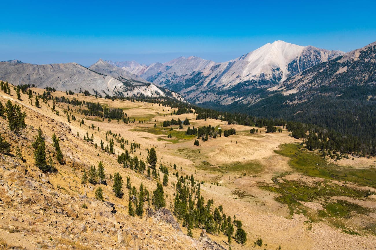
The hardest hiking was behind us. We continued on, through sporadic stands of pine forest and open rocky areas. It was getting smokier as the day progressed. We entered the open Ants Basin area which yielded wide open views of the White Clouds mountains to the North. The trail started to switchback up a pass and we were treated to a grand view of the Ants Basin and surrounding mountains.
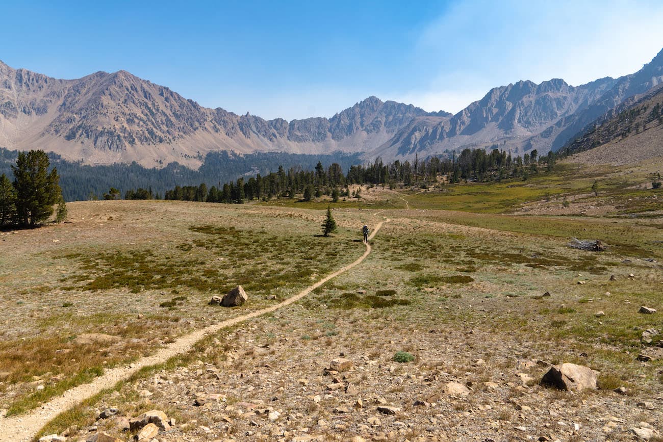
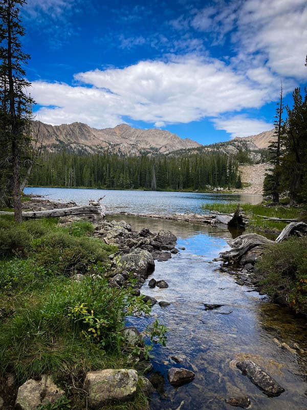
We continued on leaving the Ants Basin behind and Fourth of July Lake came into view on the valley floor below. The end of our hike was near. The moderately graded trail took us past a large tarn and eventually took us back to Fourth of July lake, where we took the 1.5 mile trail back to the parking lot.

This had been a wonderful trip. Lots of gorgeous unique views and not many other backpackers. I would definitely to it again. After the rugged 14 mile drive on a gravel road back to the main highway, we saw a huge smoke plume coming from the South a few miles away. High winds had apparently whipped up the wildfire into a roaring blaze. We were lucky to have completed this hike when we did because the smoke and fire continued to get much worse in the following weeks before eventually being put out from the weather.